|
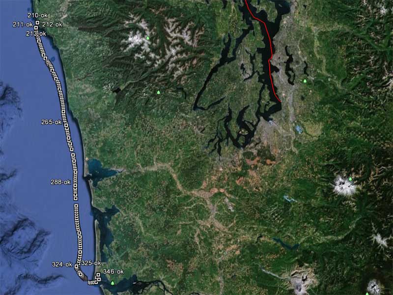
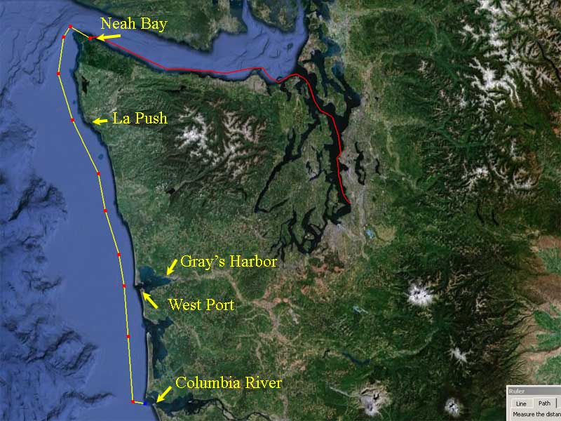
The Great Sail of 2012 For most of my life, I was never interested in boats. I liked my canoe, but boats . . . they were just expensive toys that require attention and money and time and effort. As a lazy, cheap b@stard, those are the very things I like to hoard. Then my dad told me a story about a sailing trip he took with my uncle, grandfather, and cousin. That trip went from Anacortes to (eventually) Pasco, and it had EVERYTHING: Beautiful days, a hurricane, rescue by the Coast Guard, groundings, a fire and a sinking. Well, I was hooked. I learned how to sail and started having adventures of my own. But no matter what I did, no matter where I went, I still never sailed down the coast of Washington and up the Columbia. Then one day, out of the blue, I got a call from a fellow adventurer and sailor, Greg. He wanted someone to crew for him, on a trip from Tacoma to Portland. Was I up for it? Yew betcha! The trip was roughly 350 nautical miles and should take about four days. The nights were chilly (high 40°s) but no rain anticipated. Greg said he was going to provide food (but I brought Clif Bars anyhow) and we met a a friend's house in Milwaulkee to stash the cars. At about 11pm on Saturday night, August 25, 2012, our adventure began.
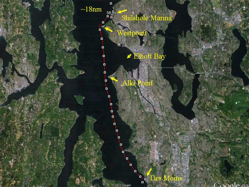
(this is a sailing story, there's gonna be a lot of maps, get used to it You might want to see what a knot and nautical mile are, as well.) A little over 3 hours to get there, Greg driving all the way. It's hard to explain how keyed up a person can get at the start of an adventure.
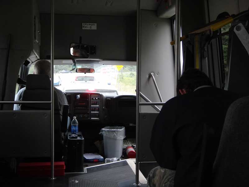
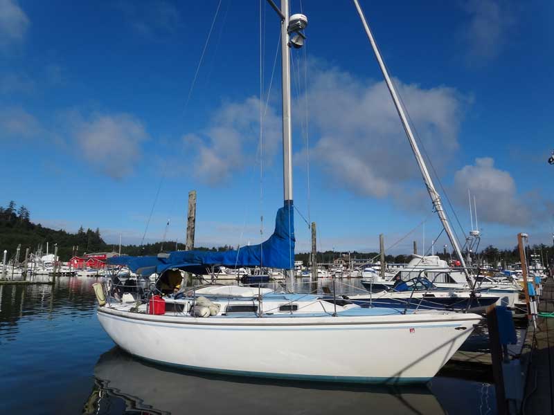
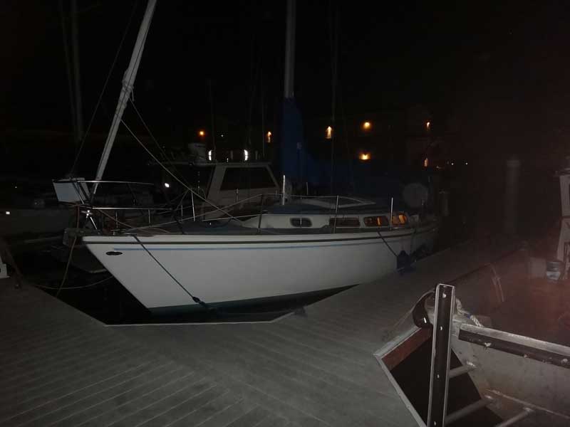
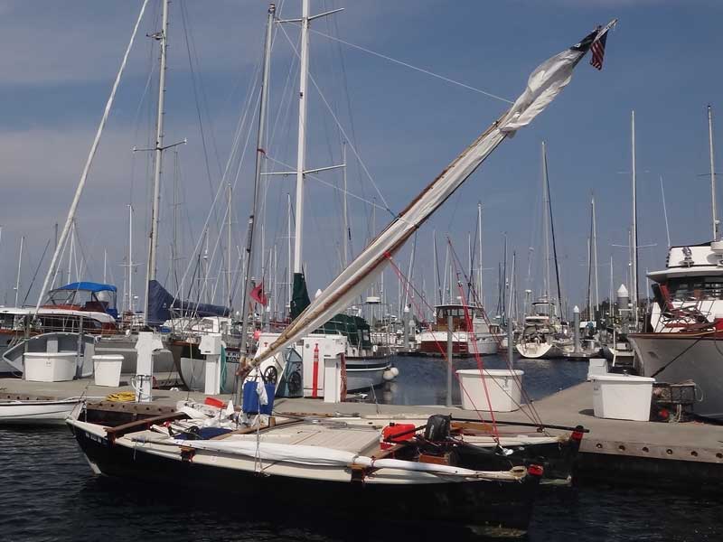
We woke up the night watchman and he let us down to the docks where we got our first look at her. The Mystery is a 30' sloop (rigged for and aft, single mast, a jib and a main sail) and had all the bells and whistles: 7 sleeping berths, a galley, icebox, sink, toilet, even a shower. She is HUGE. We set about getting her ready to sail. The fuel dock wouldn't open until 7:30am, but it was a few miles away - we wanted to be going no later than 5am, but we discovered the running lights - bow and mast head, specifically - were not working. While filling the water tanks, we found the water pump wasn't working, either. Since we couldn't leave until after dawn because of the lights, we set about stowing our gear and making sure everything else worked. Greg used his smartphone to locate chandleries (places that sell boat parts) along our route.
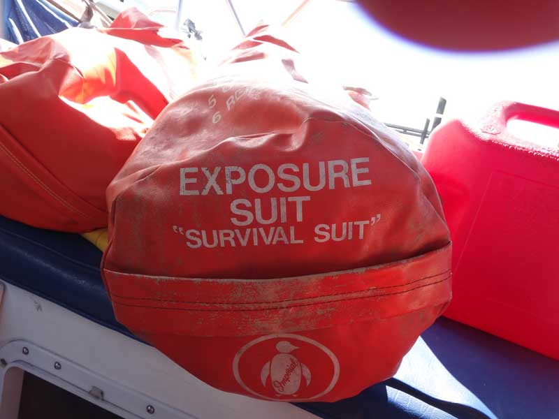
Speaking of gear, this is not a trip to be taken lightly. Greg had made sure we were prepared in case the worst should happen. I wonder why they have Survival Suit in quotation marks?
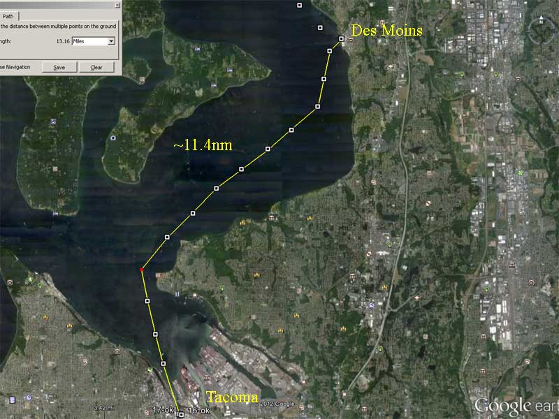
First thing to do was get out of the harbor at Tacoma and get to the refueling dock at Des Moins. We'd filled our 5-gallon gas can just before getting to the marina and used it to get us to Des Moins.
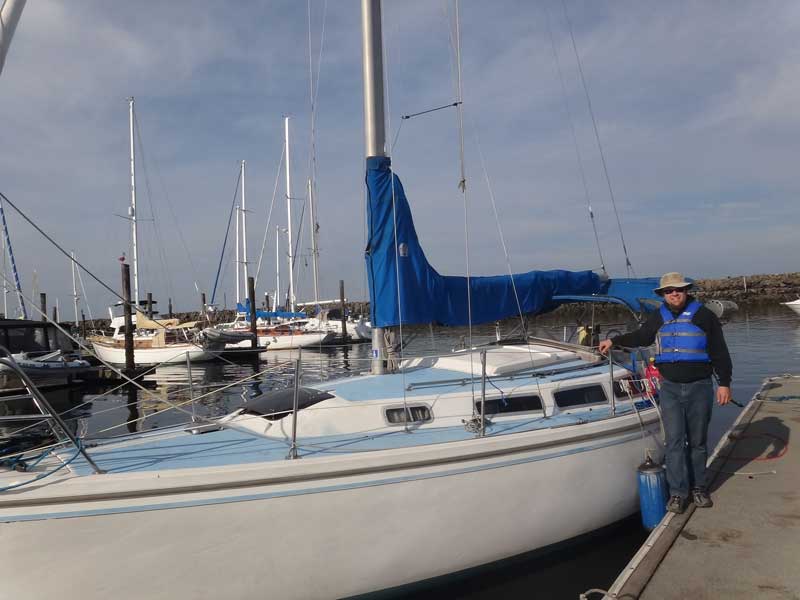
Here we see Captain Greg at the fuel dock. One thing that was odd about this boat was she has a gasoline engine, an Atomic Four, to be precise. Usually boats of this size have diesel engines. This was to be a recurring problem throughout the trip. The boat had an 18-gallon tank and Greg'd brought a 12-gallon and a 5-gallon portable tanks for reserve. We weren't about to get stuck.
We'd hoped to run as non-stop as possible (schedules make for poor sailors) but we still needed to pick up some portable nav lights and a replacement water pump. The closest West Marine was at Shilshole marina. We were running at about 4 knots, so we figured 4+ hours to get there.
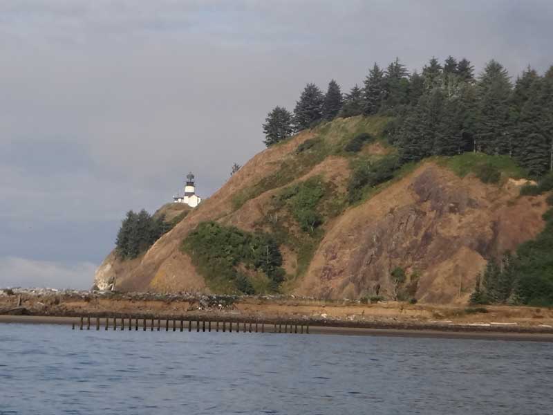
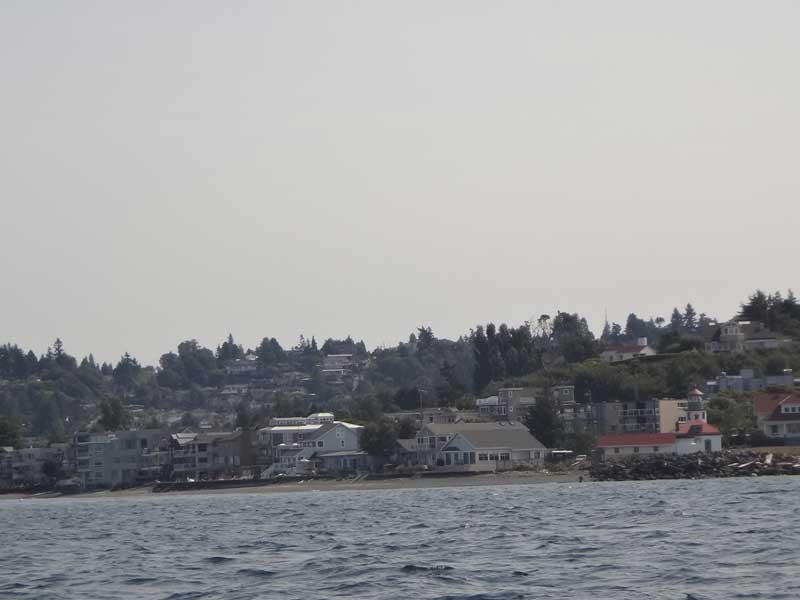
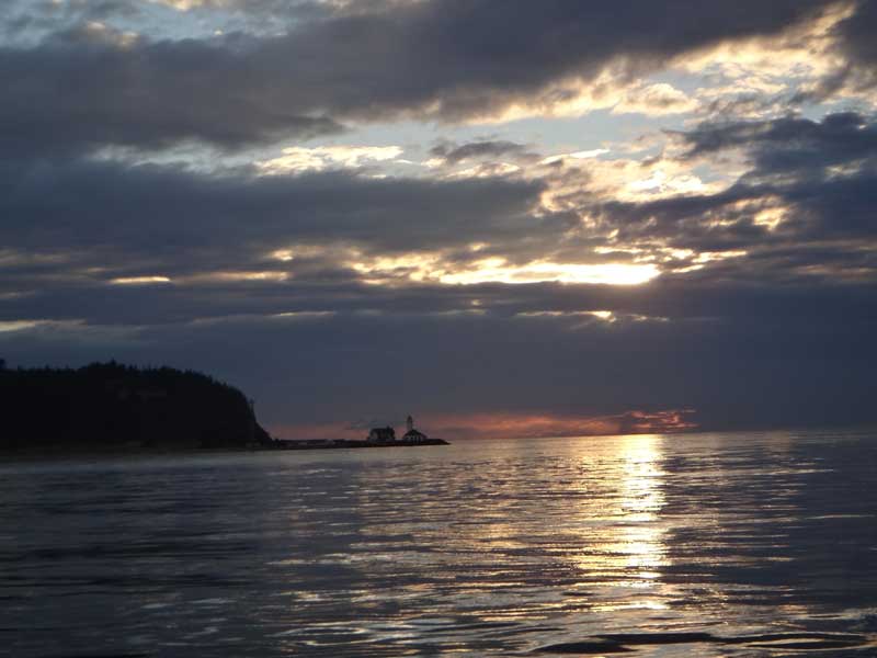
We didn't have a lot of time to spare,but that didn't stop us from appreciating the sights. That lighthouse at the lower right is Alki Point lighthouse, at the southern end of Elliott Bay. My cousin lives in a house up there on hill somewhere. I tried to call him and tell him to come out and wave, but he didn't answer. I wonder if he is still mad at me because I nearly killed him on our last sailing trip to Sucia Island.
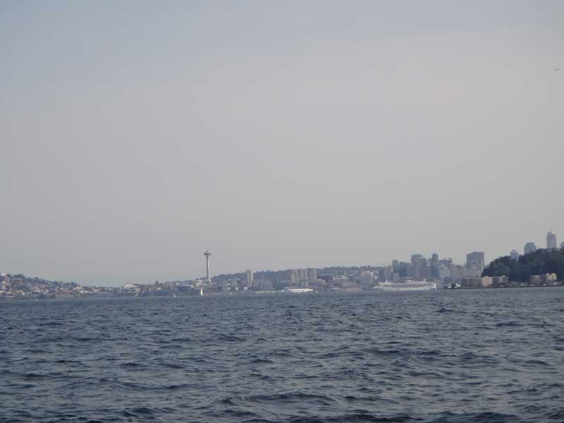
Seattle as seen from Elliott Bay.
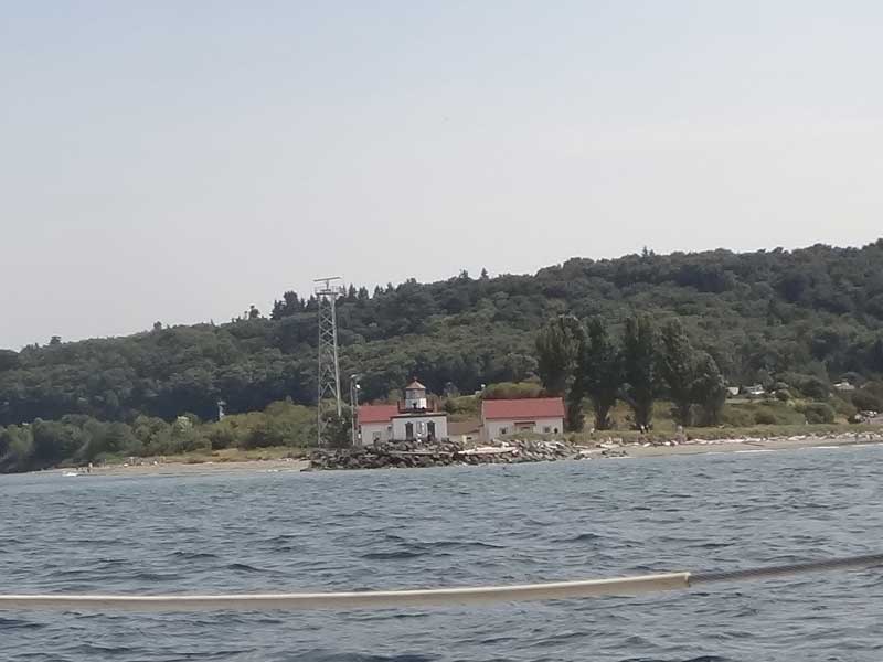
West Point is the northern end of Elliott Bay
We pulled in to Shilshole Marina to hit the chandlery. They had some pretty good boats there - lots and lots of sailboats, including this catamaran which might even be sporting a crab claw sail - those spars are fiberglassed bamboo. It was Sunday, so there was no one to answer our hail requesting directions to the transient docks, so we just picked a slip and tied up. Greg went out to get the parts while I stayed back to open the security gate when he returned. The people at the docks were giving me stink-eye since I obviously didn't belong there and I was checking out the boats.
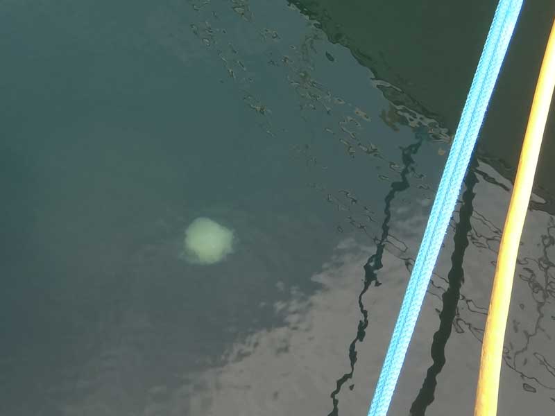
The water clarity was incredible. That jellyfish was at least 8 feet under the surface.
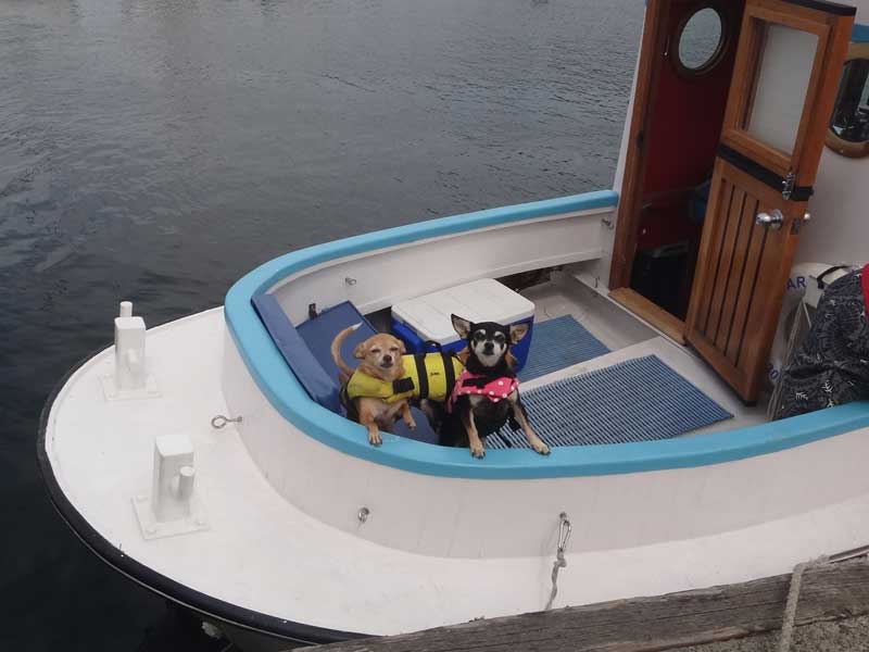
I love people who love their dogs enough to put 'em in life jackets. Look at these guys, sea dogs through and through.
Greg got the parts and made the repairs and we got under way. We had nothing to stop us, now, except the need for fuel, so our next stop was Neah Bay to get gas just before we leapt out into the Great Salt Sea.
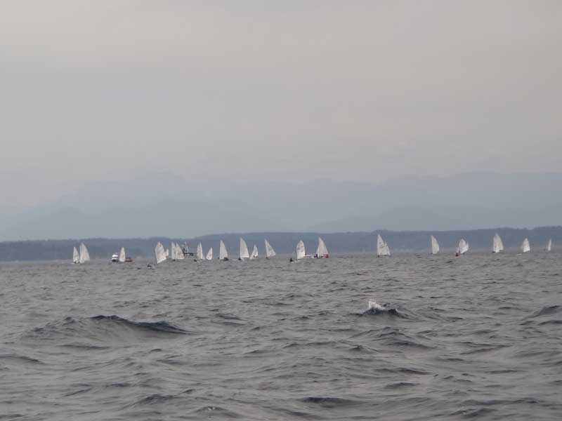
There was a whole mess of Optis out playing in the sound when we left Shilshole. We stayed out of their way, but man, were they fun to watch. Rich people have the neatest toys, don't they?
I napped until 6pm (as crew, it is my duty to be well rested at all times in case I am needed in an emergency) and then I took over the helm. My tasks were simple: Set the autopilot to the course Greg decided, plot our position on the map every hour, staty out of the shipping lanes, and watch out for flotsam - and there was a lot of it. Crab pots are a hazard, too.
Our speed varied from the low 3s when the tide was against us to over 6 when the tide changed. As my shift progressed, we kept going faster. We even bumped over 8 knots several times.
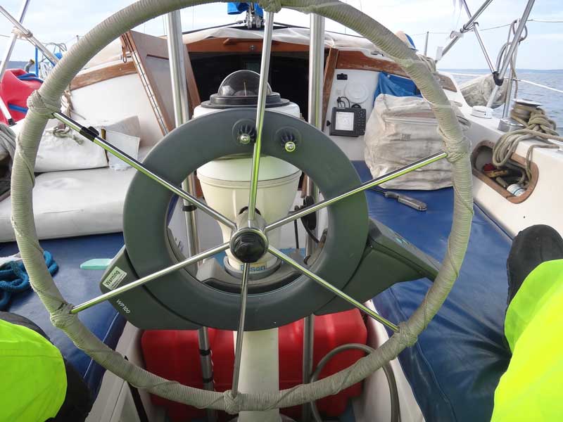
That autopilot I mentioned earlier is an older model and we couldn't put in whole routes - all we could do is set a heading and then monitor it. You can see how I had to sit when behind the wheel: The seat was too high for my feet to touch the cockpit sole, and rather than just let them dangle, I'd put them up on the bench seats on either side of the wheel. Not very comfortable, but better than feeling like a kid at the grown-ups table at Thanksgiving dinner.
The passage up the sound was as close to ideal as you can imagine. I snapped this picture of Admiralty Head light house on Whidbey Island and later spotted my first porpoise off Marrowstone Point.
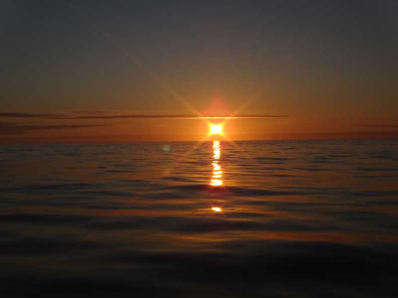
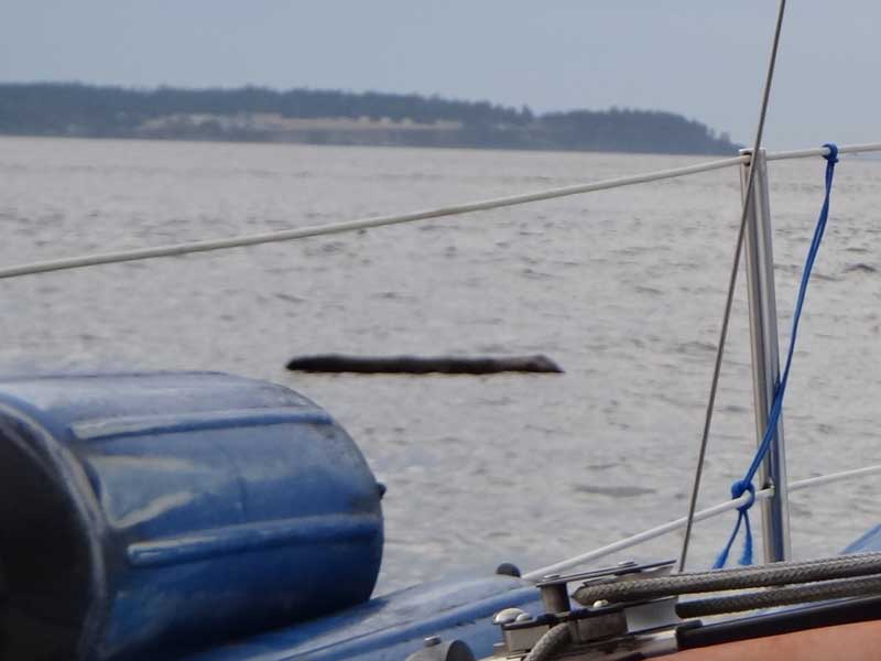
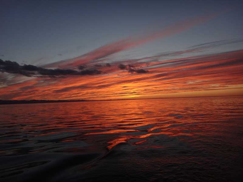
A delightful evening sky. Look how flat the water is. Barely the slightest puff of winds. Nighttime can play tricks with your eyes. Some time after Port Townsend, I saw a log floating off to starboard. At one end of the log was what looked like a head sticking up out of the water - like a seal 'standing up,' except the head was too small for a seal. An otter? Do they have otters up here? It looked like the head was nodding and peering around, but I finally decided it was just a knob on the end of the log, bouncing in the swell.
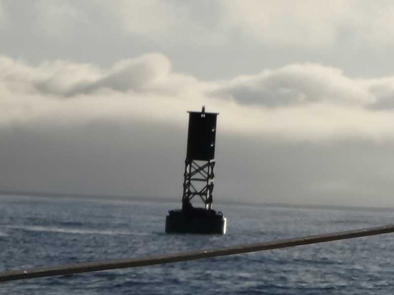
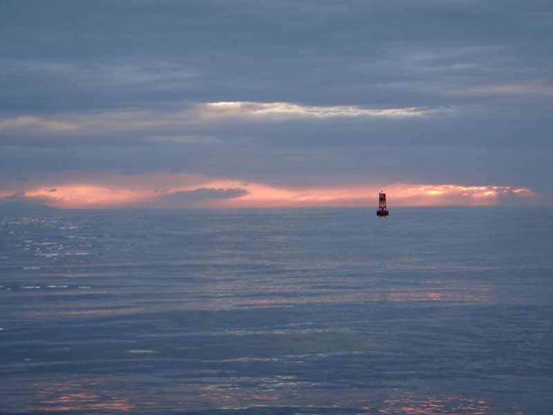
I went off watch at 11 or so and came back at 3am Monday the 27th. In the dark, I'd seen a seal blowing and snorting on the surface, but little else. Sometime around 6am I took this surreal picture of a buoy in the clouds.
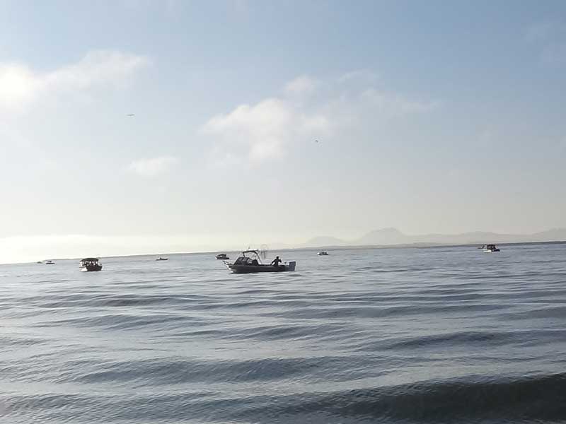
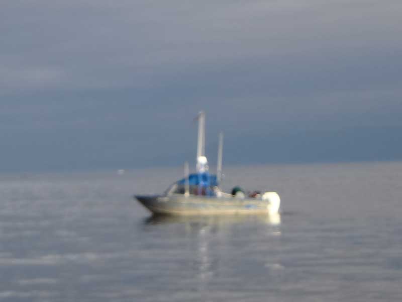
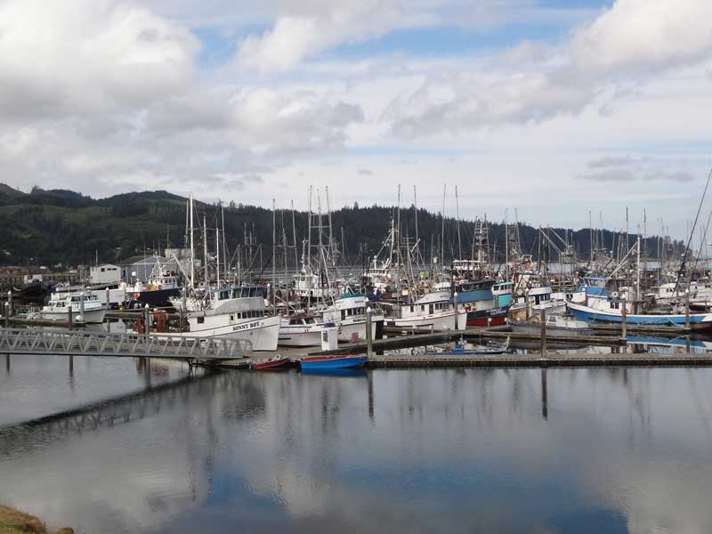
Sorry for the picture quality, but this guy had just caught a fish. We were off the big town of Sekiu, Wa and there were at least 28 fishing boats in the water, and there were several anchored just at the US/Canadian boarder as well. Gotta get those salmon, you know.
We hit Neah Bay just after 11am on Monday. There was a Small Craft Advisory in effect for the waters out off shore until 5pm, but that was OK, since they'd just run out of gasoline at the fuel dock and we had to wait for the truck to come - not scheduled until about 2pm, anyhow. We ate at the Warm House restaurant. I was a little disappointed - Neah Bay is on the Makah reservation and I was hoping for a little whale on the menu. (when pulling into the harbor, Greg emphatically stated: "This is a reservation, Andy. No jokes. They aren't going to care that your wife is a Wasco.")
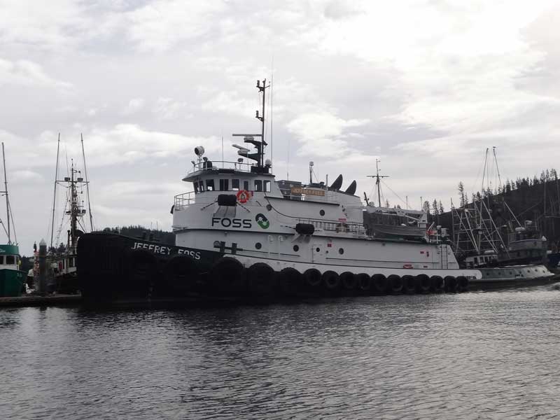
Neah Bay is a working harbor - no sailboats here - and the Jeffery Foss is a working tug, that's for sure. Did you know you can find the current location, speed, direction, destination,and track of any commercial vessel? Neither did I. Greg had an app on his phone that would tell us what ships were near us and where they were heading.
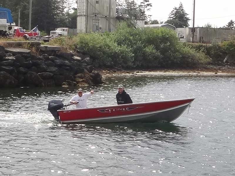
Ever wonder what commercial fishermen do when they have some time off due to weather? They go fishing! These guys were up from California, chasing tuna, and their captain had pulled to get out of the way of the Small Craft Advisory. They rented a skiff and went out for Lingcod.
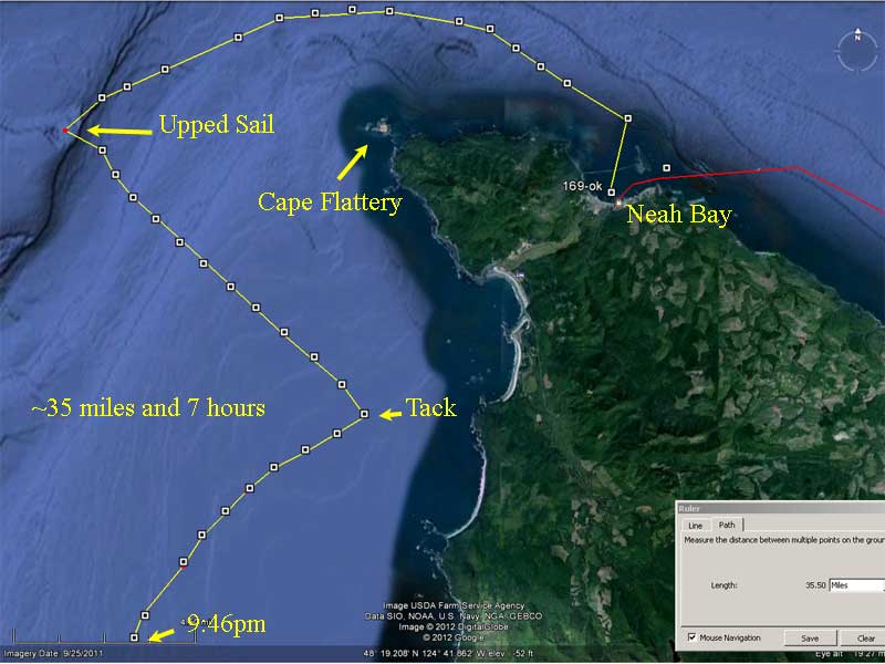
With the weather mitigating, we headed out of Neah Bay just before 3pm. The seas around Cape Flattery were a little rough, but not terrible. 4-5 foot swells with 2-3 foot waves.
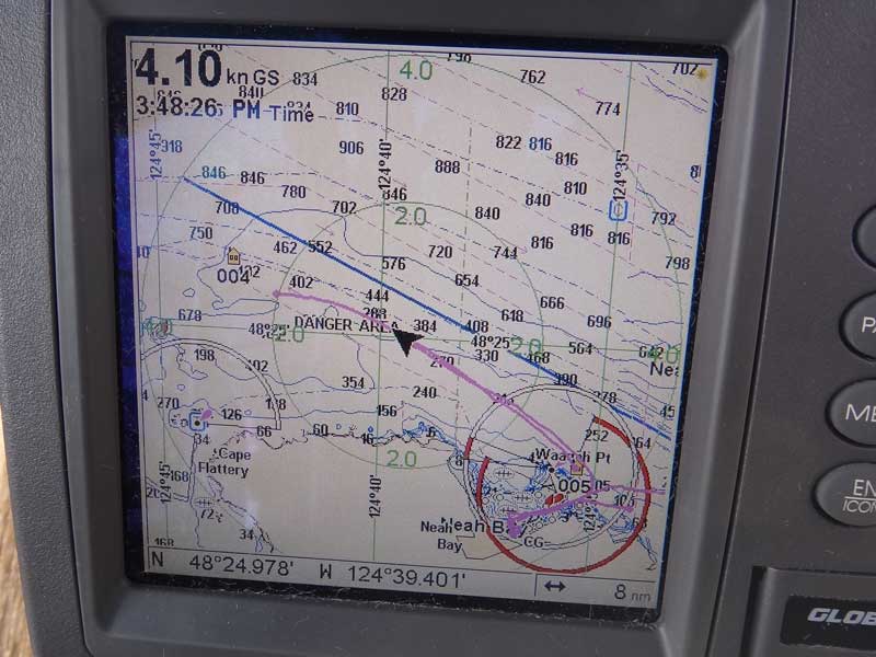
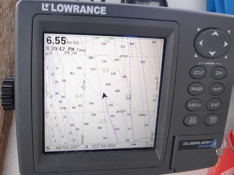
Look closely at this GPS screen. Our boat is the black triangle in the middle and we are more or less following a pink-ish path laid down by the last time this GPs had been in this area. See the words directly in front of us? DANGER AREA? See how that pinkish path from the previous trip sort of just stops out there? I wonder what happened. We had a real neat run from Neah bay around Cape Flattery. A whale paced us a little over a half mile away, between us and the shore, for the whole distance.
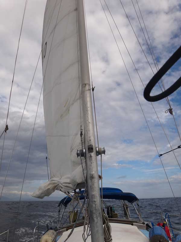
We had a nice wind - maybe 10-12 knots - but right in our face. At about 6pm, Greg wanted to up-sail to give us some stability in the wallowing seas. We shucked the sunbrella covering on the main and hoisted away. Take a close look at the winch on the left side - see how the halyard changes from 5/8 line to wire just above the winch? Now look down a bit - see how the sail is reefed? That's right - we couldn't hoist the sail to its full height without twisting the wire around the winch, and that ain't right. Who the eff rigged this boat in the first place?
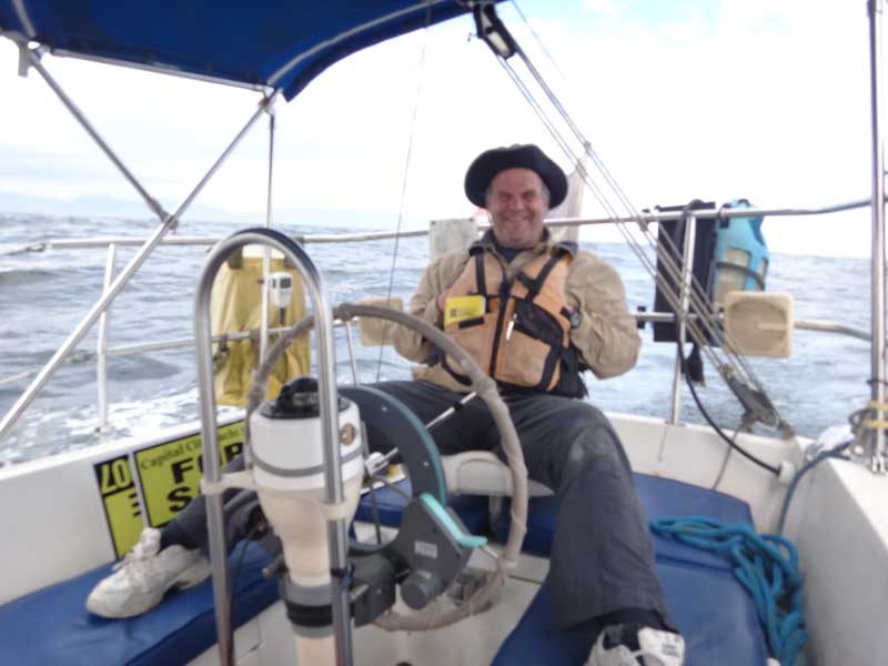
Disgust with the riggin or not, I was happy to take over the wheel and see if I could sail this beast into the wind. This boat is twice the size - and even 3x the siz, of boats I normally sail, so it was a challenge.
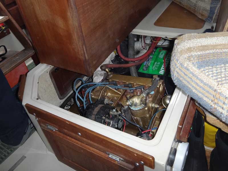
I conned the helm manually, trying to pinch as close as possible to the wind. Greg had given me instructions as to the course and the distance I needed to maintain from shore. The wind and seas were dead on our nose, but dropping. At about 9:30pm, the wind had died and the seas were down to maybe 2 feet total - wave and swell - with the occasional 3 feet. I woke Greg and asked it it'd be OK if I just headed straight into the wind so we could make the best possible Velocity-Made-Good to our destination. Shortly after changing course, Greg came up and asked how things were going. I said "Fine, just a little bumpy." Within a minute or two of that statement, the engine died. Just flat out quit. Greg said "I thought I heard a change in pitch - that's why I woke up." and started tearing into the engine. We'd been told there'd been a total tune-up done, new fuel filter, spark plugs, and carburetor rebuild.
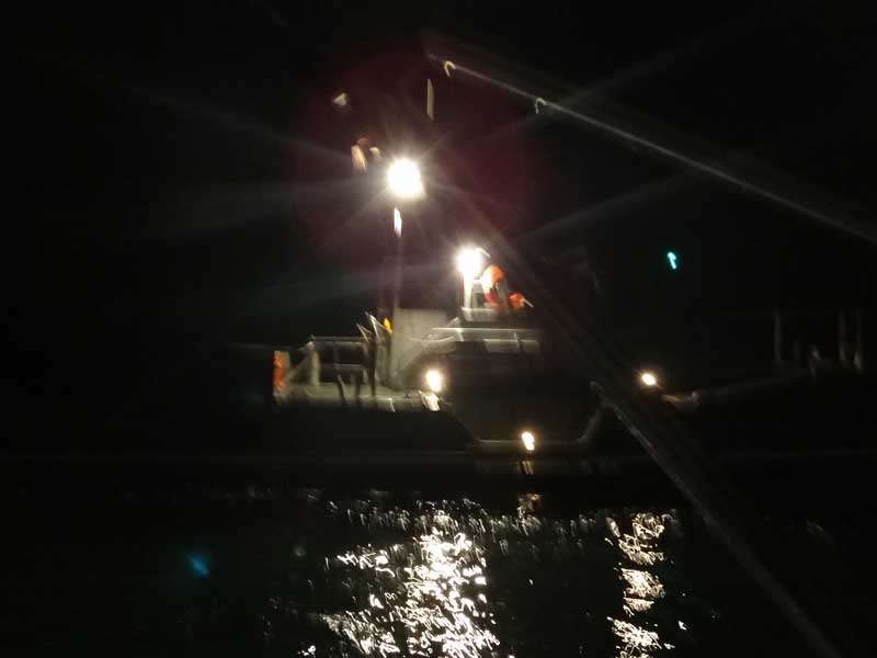
Opening the engine compartment quickly showed us there hadn't been any tune-up. The oil might have been changed, bit not the spark plugs or fuel filter. Greg could see where a mechanic had tried to remove the filter, but it was clearly old. Greg deduced our problem was most likely water in the fuel, most likely caused by condensation in the tank from sitting empty for so long. We didn't have a replacement filter, nor the tools to remove the existing filter. Greg said "We can f#%k around here for a few hours, get no where, and then call for help, or we can call for help now." We were halfway between the Neah Bay and Quillayute River Coast Guard stations. The CG is required to have you use a commercial towing service if one is available,and a commercial towing service costs a lot. There is a commercial service out of Neah Bay, but not out of Quillayute River - plus, Quillayute River was towards our destination while Neah Bay was back tracking. Greg called the Quillayute River CG station.
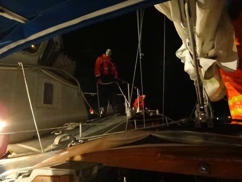
Greg has a CG Captain's license, so it was fun to listen to him talk on the radio in perfect, official, radio-ese. The poor kid on the other end of the line had to go wake up the duty officer, then get things moving. As they approached, I pulled out my camera and Greg warned me "No flash photography!" Damn, what a buzz-kill. This is a no-flash photo from a pitching boat - not too bad.
Again - no flash, pitching boats on the water. They towed us in to La Push, then tied up along side us and guided us in to the slip. We were at the dock by 4:30am. I'd gone to bed during the tow ('cuz it's my duty to be rested, remember?)
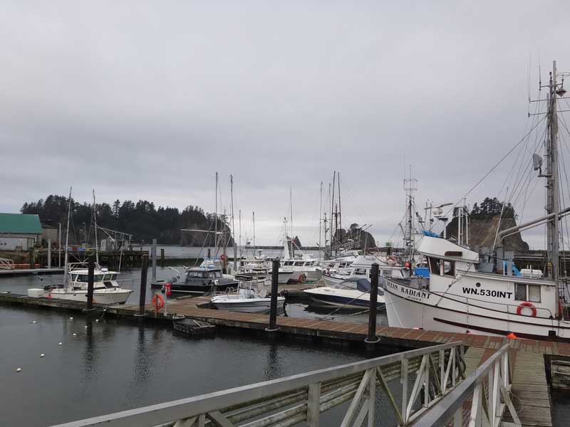
La Push is a beautiful little fishing village with the dramatic rocks of James Island protecting the harbor. Again: A working harbor - not a sailboat in sight. Look in the lower right - that's a gillnet
There were no parts in La Push, so we took the community bus into the big town of Forks (claim to fame: Site of the Twilight films) and bought every fuel filter the store had, as well as a filter wrench, another 5-gallon gas can, and some other things we needed to effect repairs. Water in the fuel was, indeed, the culprit. Greg replaced the filter, drained some of the tanks, and got things going again. Doing the math on travel time and tides at the mouth of the Columbia, Greg decided our time would best be used by getting a good, long rest and leaving at 6am Wednesday morning.
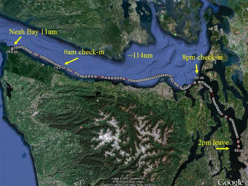
Now it was just a dead run down the coast, a little over 120 miles, or roughly 26 hours at 4 knots. The boat's fuel tank could hold enough to cover 90 nautical miles or so, so we planned on filling from the reserve tanks while under way. Our goal was to arrive at the mouth of the Columbia just after the start of the flood tide.
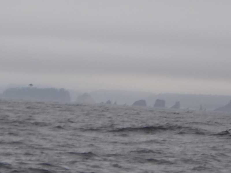
The coast of the Washington peninsula is dramatic - formed volcanically, it has massive basalt structures all along the shore and the water drops off to 60 feet deep within a half mile of land. These are the Quillayute Needles.
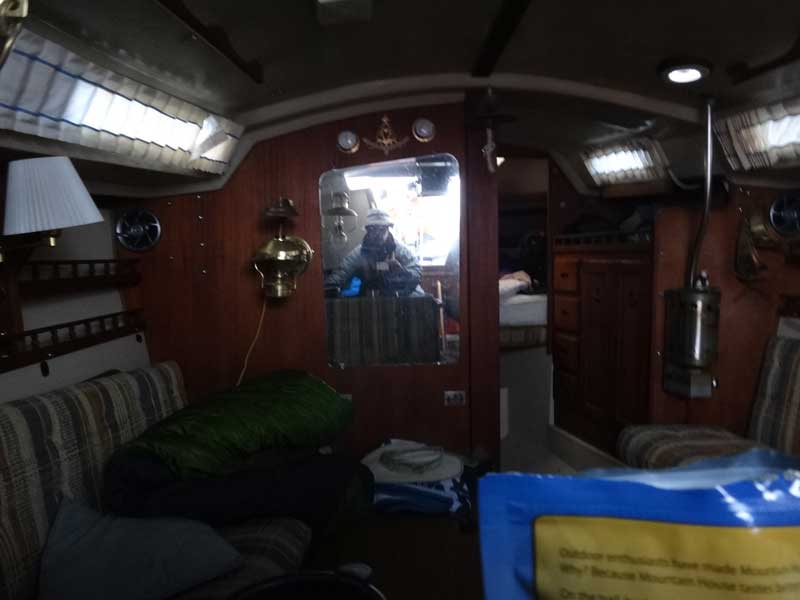
Here's my attempt at a MySpace photo - my reflection in a mirror. It does show the size and scale of the interior of the boat, that's for sure.
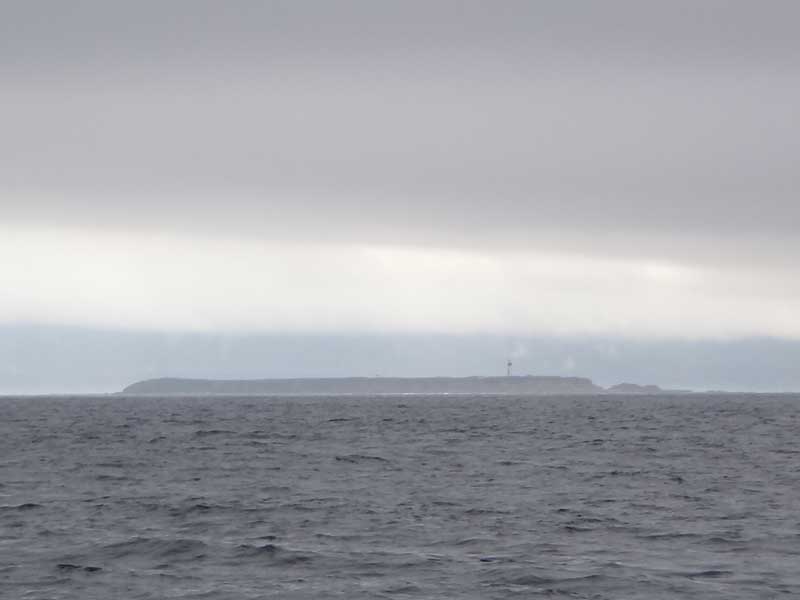
Destruction Island. The light is now abandoned. The Spaniards were the first to name this rock: Isla de Dolores - Island of Sorrows. What a happy place. Does that article say the Rhinoceros Auklet is in decline because of predation by European rabbits?
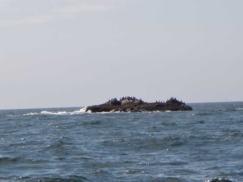
Sea Lion Rock is just a big rock, sitting all by its lonesome in 60 feet of water. It's a couple miles off shore, surrounded by nothing. Just a solitary rock, waiting to bash your boat to smithereens.
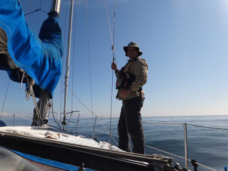
Obligatory shot of me in the shrouds. Take a look at how flat that sea is.
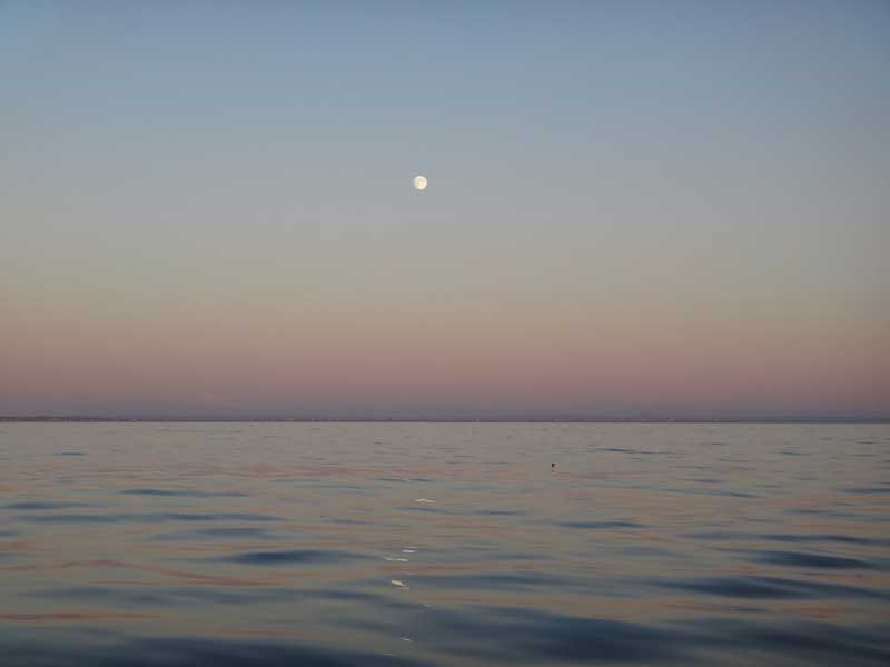
Oh, my, it was calm out there. "Pacific" ocean, indeed.
No Green Flash, not ever. It doesn't exist.
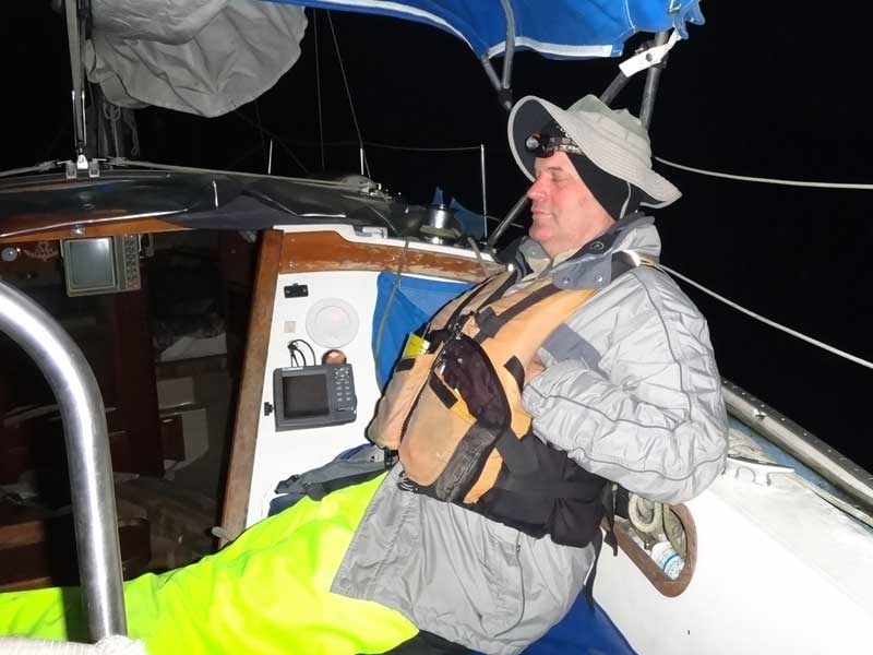
I changed into my night gear as the sun went down. It got damn cold out there.
Buoy 12 at the mouth of the Columbia. We were getting close - and it was a damn good thing, too. The engine was starting to misbehave again - starting ot cut out intermittently. The Columbia - especially the mouth - is no place to be mucking about with a balky engine.
Salmon fishermen at Buoy 10. Gotta get out there, you might catch the last one.
Cape Disappointment light. You hear stories of the sailing conditions in other parts of the country - the shallows of the Outer Banks, the sharks of Florida, the oyster reefs of the Texas Gulf coast, but they don't name their landmarks like we do.
We pulled in to the harbor at Ilwaco - the first harbor we could - because the engine was really getting cranky. Greg suspected an ignition problem, probably the coil, distributor cap, or points. We checked at the chandlery but they had no engine parts. We were running behind schedule and Greg had a 'real' job he needed to be at the next night. There just wasn't time to continue. We called for an extraction, buttoned things up, and Grg and his wife will bring the boat in the final 90 miles starting Sunday, September 2.
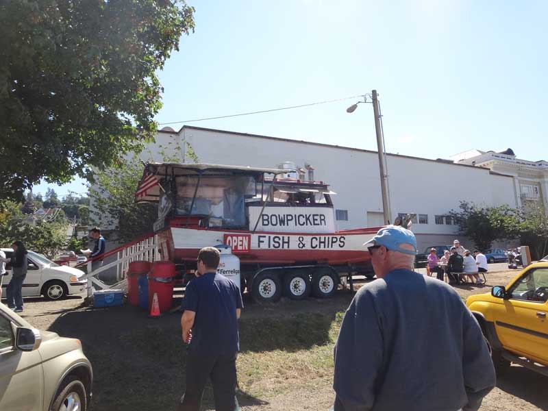
The real hero of this story is Jim B., our friend who let me stash my car at his place in Milwaukee when we started. I called Jim and asked if he'd mind coming to pick us up, he said "Sure," dropped everything, and came up to Ilwaco and got us. He wouldn't even let us pay for lunch at the Bowpicker in Astoria. Bowpickers were very important to the economy (and ecology) in the early days of Oregon's history. |
 By this
time, we had a good idea of our fuel consumption and speed. After
refueling, we had a total of 35 gallons of gasoline (18 in the tank,
a 12-gal portable and a 5-gal portable.) We were consuming an average
of .8 gallons an hour at 4 knots, giving us a max theoretical range
of 175 nautical miles. The mouth of the Columbia was right at the
outer edge of that range, so we were going to have to stop somewhere
along the way to refuel.
By this
time, we had a good idea of our fuel consumption and speed. After
refueling, we had a total of 35 gallons of gasoline (18 in the tank,
a 12-gal portable and a 5-gal portable.) We were consuming an average
of .8 gallons an hour at 4 knots, giving us a max theoretical range
of 175 nautical miles. The mouth of the Columbia was right at the
outer edge of that range, so we were going to have to stop somewhere
along the way to refuel.